How to Recognize Countries Faster in GeoGuessr
Fast country identification follows a process of elimination.
Instead of asking:
“What country does this look like?”
Ask:
“Which countries are still possible after what I can see?”
A tropical location could be found across several continents. But tropical vegetation combined with left-hand traffic, a particular writing system, distinctive road markings, and certain utility poles can reduce dozens of possibilities to only a few.
The goal is to build confidence from multiple independent clues.
Look for hard evidence before scenery
Strong clues include:
Supporting clues include:
climate;
soil;
architecture;
terrain;
vegetation;
general road quality.
Scenery is valuable, but it should usually support stronger evidence instead of replacing it.
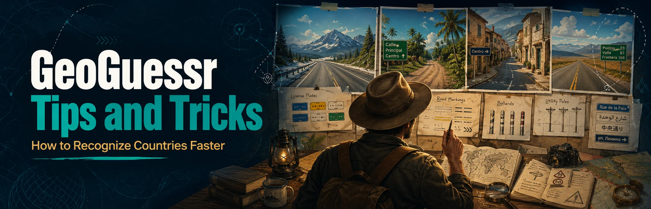
Use a Fast Clue Priority System
When a new location appears, train yourself to scan for high-value information immediately.
A useful priority is:
Text → traffic → road → vehicles → infrastructure → environment → camera clues
You do not have to inspect these in exactly the same order every round. The principle is to search for clues capable of eliminating the largest number of countries.
Text can solve a round instantly
Look for:
alphabets;
road signs;
storefronts;
town names;
websites;
advertisements;
vehicle writing;
public notices.
Even when you cannot translate the text, its alphabet or spelling patterns may identify the region.
Roads provide clues even without text
On empty rural roads, inspect:
center lines;
edge lines;
line colors;
shoulder design;
bollards;
chevrons;
road surfaces.
GeoHints maintains separate country references for road lines, bollards, road-numbering signs, license plates, traffic lights, and many other infrastructure clues because their designs vary significantly between countries.
Learn Language Fingerprints Instead of Entire Languages
You do not need to speak every language used in GeoGuessr.
You need to recognize visual fingerprints.
A few letters can sometimes be more useful than understanding an entire sentence.
Scandinavian Language Clues
Norway, Sweden, and Denmark frequently confuse newer players because the scenery and languages can appear similar.
Sweden
Look for letters such as:
å, ä, ö
Swedish commonly uses ä and ö.
Norway and Denmark
Norwegian and Danish commonly use:
æ, ø, å
The presence of ø or æ can therefore push you toward Denmark or Norway rather than Sweden.
Players frequently use these spelling differences as quick Scandinavian separators.
Once language narrows the possibilities, use terrain and infrastructure.
Norway is generally far more mountainous.
Denmark is predominantly low and flat.
Sweden varies considerably, so scenery alone should not override a clear language clue.
Spain vs Portugal
This is one of the most common European mistakes.
Do not rely only on dry terrain, tiled buildings, or Mediterranean architecture because both countries can share these features.
Portuguese clues
Watch for:
Spanish clues
Common words include:
Portuguese can sometimes look like Spanish at first glance, so individual letters and common street words are extremely useful.
Architecture, utility poles, road markings, and sign designs can then confirm the choice.
Russia vs Ukraine
Cyrillic immediately narrows the possibilities, but it does not automatically mean Russia.
Ukrainian contains several distinctive characters, including:
і, ї, є, ґ
Russian instead includes letters such as:
ы, э, ё, ъ
A particularly useful text clue is the word for street. Ukrainian commonly uses forms beginning with вул., while Russian commonly uses ул.
You should still combine language with road quality, architecture, landscape, and coverage rather than identifying the country from one blurry character.
Learn Driving Side Early
Traffic direction is one of the fastest country filters.
Left-driving countries that commonly matter in GeoGuessr include locations such as:
United Kingdom;
Ireland;
Australia;
New Zealand;
Japan;
Indonesia;
Malaysia;
Thailand;
South Africa;
Botswana;
Kenya.
Once left-hand traffic is confirmed, many other countries disappear from consideration immediately.
Confirm it correctly
Do not judge traffic direction from one parked vehicle.
Check:
several moving vehicles;
lane positioning;
intersections;
signs facing traffic;
buses;
road arrows.
Incorrectly identifying driving side can send your entire deduction in the wrong direction.
License Plates Can Identify a Country Surprisingly Fast
You often cannot read plates because they are blurred, but their color and shape remain visible.
GeoHints currently catalogs front and rear plate patterns across countries and, where relevant, regional variations.
Netherlands
Dutch civilian plates are famous for their strong yellow appearance.
When you see yellow plates on both ends of vehicles in a flat, northern European-looking environment, the Netherlands becomes a strong possibility.
United Kingdom
Standard UK cars usually have:
white front plates;
yellow rear plates.
Combine that with left-hand traffic and British road infrastructure.
Colombia
Yellow vehicle plates are an extremely useful Colombian clue.
If you see numerous yellow plates in a Spanish-speaking South American environment, Colombia should move high on your shortlist.
Be careful not to identify countries purely from one distant plate. Color distortion, commercial vehicles, and unusual plate types can mislead you.
Road Lines Are One of the Best Rural Clues
A completely empty road may still contain enough information to identify the country.
Look at:
GeoHints documents numerous combinations of white, yellow, red, blue, and other road-edge and center-line systems across covered countries.
Do not try to memorize every combination immediately.
Instead, learn the road systems of countries you confuse most often.
Bollards Are Powerful Country Clues
Bollards are among the most useful infrastructure clues in European GeoGuessr.
Their differences can include:
GeoHints maintains a large country-by-country bollard reference because their designs can be geographically distinctive.
Learn shapes, not names
You do not need to know the official name of the roadside marker.
Train your brain to recognize its silhouette.
Eventually you begin seeing a bollard and thinking:
“Central Europe.”
Then:
“Probably Austria or Slovenia.”
And eventually:
“This specific design strongly favors one country.”
That progression is much more useful than memorizing dozens of definitions.
Road Signs Work Even When You Cannot Read Them
A sign can provide information through:
shape;
border;
background color;
mounting;
font;
arrow style;
road shield shape;
post construction.
Even the back of a road sign can sometimes help distinguish countries because mounting hardware and sign construction differ. GeoHints specifically maintains references for sign backs and multiple sign categories.
Road-number shields are especially valuable
A road number may tell you more than the number itself.
Countries use different shield shapes, colors, prefixes, and numbering conventions.
When you recognize the road-number format, you may identify the country before you ever locate the road on the map.
Utility Poles Can Separate Similar Countries
Utility poles become increasingly useful as you improve.
Look for:
Poles are especially useful when language and road signs are unavailable.
Indonesia, Thailand, Brazil, Mexico, parts of Eastern Europe, and other regions may all have recognizable infrastructure patterns once you learn what to look for.
Avoid treating one generic concrete pole as proof. Pole clues work best when the design is distinctive or when several similar poles appear.
Recognize Europe Faster
Europe can be difficult because many countries share:
similar architecture;
EU-style road signs;
white license plates;
temperate vegetation;
well-maintained roads.
The solution is to identify smaller regional groups first.
Nordic countries
Use:
language;
road lines;
bollards;
terrain;
architecture.
Norway's dramatic terrain can be useful, while Denmark is generally much flatter. Sweden and Finland frequently require closer attention to language, road markings, and infrastructure.
Baltic countries
Estonia, Latvia, and Lithuania are common sources of confusion.
Pay attention to:
language;
bollards;
utility poles;
road quality;
settlement design.
Learning the specific spelling patterns of Estonian versus Baltic languages provides a major advantage.
Balkans
Croatia, Slovenia, Serbia, Montenegro, North Macedonia, Albania, and neighboring countries can look surprisingly similar.
Even experienced community players regularly mention Balkan confusion as one of the harder parts of country identification.
In this region, combine:
alphabet;
road lines;
bollards;
mountains;
architecture;
sign design;
license plates.
Do not make a Balkan guess from landscape alone.
Recognize South America Faster
South America becomes much easier once you stop seeing every Spanish-speaking country as interchangeable.
Brazil is the biggest linguistic exception because Portuguese immediately separates it from most neighboring countries.
For Spanish-speaking locations, infrastructure becomes especially important.
Colombia
Watch for the widespread yellow license plates.
Combine them with:
Chile
Chile has enormous geographic variation, but elongated mountainous terrain, dry northern environments, Mediterranean central areas, and cooler southern landscapes can all become useful with experience.
Do not rely on “Chile looks dry.” Much of the country does not.
Argentina and Uruguay
These countries can sometimes feel similar around the Río de la Plata region.
Look for:
road markings;
road signs;
plates;
architecture;
terrain;
settlement density.
Argentina is geographically enormous, so landscape can change drastically depending on the region.
Peru, Bolivia, and Ecuador
High-altitude Andean environments can create confusion.
Use:
road infrastructure;
settlement architecture;
vegetation;
utility poles;
road signs;
vehicle clues.
The mountains tell you that you may be in the Andes. They do not automatically tell you which Andean country.
Recognize Africa Faster
African GeoGuessr rounds often reward knowledge of coverage and infrastructure in addition to landscape.
Several covered countries may share:
reddish soil;
tropical vegetation;
dry savanna;
English signage;
left-hand traffic.
Start with driving side and language, then inspect roads, vehicles, poles, and Street View characteristics.
Ghana, Kenya, Uganda, Botswana, and South Africa
Do not reduce these countries to “Africa meta.”
Each has combinations of:
Coverage-specific car clues can be powerful, but imagery changes over time and different maps may contain different coverage. GeoHints maintains a current vehicle-clue reference covering many countries, which is useful when studying these metas.
Learn geography first and vehicle meta second.
That gives you a fallback when the familiar camera clue is absent.
Recognize Asia Faster
Asia contains some of the most powerful script clues in GeoGuessr.
Being able to distinguish writing systems can immediately reduce the search area.
Japan
Japanese signage may combine:
Japan also drives on the left.
Architecture, utility infrastructure, road design, and mountainous terrain can provide additional confirmation.
South Korea
Korean Hangul is visually distinctive once learned.
Recognizing Hangul is one of the easiest ways to identify South Korea quickly.
Community country-streak data has historically shown that countries with distinctive scripts tend to be easier for players to identify than regions where neighboring countries share similar languages and infrastructure.
Thailand
Thai script is highly distinctive.
Combine it with:
left-hand traffic;
tropical vegetation;
road infrastructure.
Indonesia vs Malaysia
This is a classic GeoGuessr matchup.
Both may feature:
Infrastructure becomes important.
Study differences in:
utility poles;
road markings;
roofs;
road quality;
signs;
settlement density.
These countries are best learned through repeated side-by-side comparison rather than one “magic” clue.
Recognize Australia and New Zealand Faster
Australia and New Zealand share:
Terrain and road infrastructure become particularly useful.
Australia
Possible environments range from:
tropical north;
dry interior;
Mediterranean areas;
temperate southeast.
Do not assume every Australian location is dry and red.
New Zealand
New Zealand frequently has:
greener landscapes;
more dramatic mountains or hills;
distinctive road infrastructure;
cooler-looking vegetation.
However, parts of southeastern Australia and New Zealand can look surprisingly similar.
Use bollards, road lines, signs, and landscape together.
Street View Coverage Is a Real GeoGuessr Clue
Not every country has the same amount or type of official street-level coverage.
GeoHints distinguishes countries with common official coverage from rarer locations, trekker-heavy countries, and places that generally require unofficial imagery or specific maps.
Coverage knowledge prevents impossible guesses.
If your visual clues suggest two countries but only one normally appears with the type of imagery you are seeing, that information matters.
Never use coverage as your only clue
Community maps can use:
Coverage should narrow possibilities, not completely replace geographic reasoning.
Learn Camera and Vehicle Meta Carefully
GeoGuessr meta refers to clues created by the imagery itself rather than the real-world geography.
Examples can include:
These clues can sometimes produce near-instant country identification.
Why meta is powerful
A landscape may exist in several countries.
A particular coverage setup may exist in far fewer.
That can transform an uncertain guess into a confident one.
Why meta can also make you worse
If you only memorize camera tricks, you may fail whenever:
Treat meta as an additional layer on top of strong geographic knowledge.
Stop Guessing From “Vibe” Alone
Experienced GeoGuessr players often talk about countries having a particular feel.
That intuition is real, but it develops from thousands of small observations.
A beginner may say:
“This feels like Mexico.”
An experienced player may be subconsciously processing:
road width;
sunlight;
concrete poles;
soil;
vegetation;
wall construction;
road markings;
vehicle types.
That combination becomes what players call vibe.
Turn your vibe into evidence
Before guessing, ask:
Why does this feel like that country?
Try to name at least two observable reasons.
If you cannot, lower your confidence.
Use Negative Evidence
Country recognition is not only about what you see.
It is also about what you do not see.
Suppose two countries appear possible.
Ask:
Would I normally expect different road lines here?
Should traffic be driving on the other side?
Should the language contain a particular letter?
Would plates normally have a different color?
Is this type of coverage unusual there?
Does the terrain make sense?
Eliminating a country because expected evidence is missing can be just as useful as finding a positive clue.
Combine Independent Clues
The safest fast guesses come from clues that do not depend on each other.
Imagine you see:
These clues strongly reinforce Brazil.
Now compare that with seeing:
dry terrain;
red soil;
one palm tree.
Those clues are weak because they occur across many countries.
Use a confidence stack
Think in levels:
Possible — one broad clue fits.
Likely — several clues agree.
Strong — one country-specific clue plus supporting evidence.
Near-certain — direct country information or several highly distinctive clues agree.
This prevents premature guessing.
Learn Country Pairs Instead of Memorizing the Entire World
One of the fastest ways to improve is to study countries that you personally confuse.
Useful comparisons include:
Ask one simple question:
What are the three best clues separating these countries?
You will improve faster than by trying to memorize hundreds of disconnected facts.
Prioritize Clues That Appear Often
Some GeoGuessr facts are technically useful but appear extremely rarely.
Others appear constantly.
Prioritize:
language;
driving side;
road lines;
plates;
bollards;
utility poles;
common signs;
major coverage clues.
Then add niche knowledge later.
A clue that solves one round in 500 should not receive the same study time as something visible in almost every road location.
Practice Recognition Without Creating Bad Habits
Playing more rounds helps, but deliberate review helps more.
When you miss a country, determine exactly what went wrong.
Categorize the mistake
Was it:
language?
road markings?
bollards?
plates?
driving side?
coverage?
landscape?
camera meta?
overconfidence?
If you repeatedly lose on the same country pair, that tells you what to study.
Community advice consistently recommends focusing study on countries and clue categories that repeatedly cause mistakes rather than memorizing everything at once.
External resources are for practice, not competitive assistance
Studying GeoHints, Plonk It, maps, videos, and reference material can significantly improve your knowledge.
However, GeoGuessr's current Community Rules prohibit using Google or other external information as assistance during competitive play.
Use resources before or after matches so the knowledge eventually becomes automatic.
Common Mistakes When Trying to Guess Faster
Locking onto the first country that comes to mind
Recognition feels satisfying, which makes players stop checking.
Before committing, find supporting evidence.
Treating one clue as guaranteed
Most clues have exceptions.
Use combinations whenever possible.
Ignoring text because it is blurry
Even unreadable words contain information.
Look at:
script;
word length;
accent marks;
letter shapes;
sign formatting.
Looking only at scenery
Beautiful scenery attracts attention, but a boring roadside bollard may provide more geographic information than an entire mountain range.
Memorizing rare meta before basic geography
Learn road systems and languages before obscure camera artifacts.
Failing to update your guess
Your first idea is a hypothesis, not a commitment.
If new evidence contradicts it, change your mind.
GeoGuessr Country Recognition FAQ
What is the fastest way to recognize a country in GeoGuessr?
Look first for high-value clues such as language, driving side, domains, road markings, license plates, signs, and bollards. Combine at least two strong clues whenever possible.
What clues should I learn first for GeoGuessr?
Language patterns, driving side, road lines, common license-plate colors, bollards, utility poles, and Street View coverage offer some of the best returns.
How do good GeoGuessr players guess countries instantly?
Experienced players have seen the same infrastructure, landscapes, languages, camera coverage, and road systems many times. Recognition becomes automatic because they process multiple clues simultaneously.
Are license plates useful in GeoGuessr?
Yes. Even blurred plates reveal color, shape, front-versus-rear differences, and sometimes regional patterns.
Are bollards worth memorizing?
Yes, particularly for Europe. Some bollard designs are strongly associated with specific countries or small groups of countries.
How can I distinguish countries that look similar?
Study them as pairs. Learn a few reliable differences in language, road markings, signs, bollards, plates, utility poles, and terrain.
Should I learn GeoGuessr meta?
Yes, but after building basic geographic knowledge. Camera and vehicle meta can be extremely powerful, but it is safer when used alongside real-world clues.
Is landscape enough to identify a country?
Sometimes, but rarely with complete certainty. Climate and terrain are best used alongside infrastructure, language, and coverage clues.
How do I get faster without making more mistakes?
Reduce the number of clues you inspect, but increase their quality. Search for decisive information instead of reacting to every object in the scene.
Final Tips for Recognizing Countries Faster
Fast GeoGuessr players are not necessarily seeing more than everyone else.
They are filtering information better.
A language may eliminate an entire continent. Driving side may remove half the remaining countries. A yellow plate, bollard, utility pole, or road-line pattern may narrow the choice again.
The most useful habit is to repeatedly ask:
What does this clue eliminate?
Learn the countries you confuse most, build a hierarchy of reliable evidence, and stop making guesses based on scenery alone.
Once these patterns become familiar, country recognition begins to feel almost instant—not because you are guessing, but because you have learned where to look.