Why Road Signs Are So Useful in GeoGuessr
Traffic systems are standardized within countries, which means the same visual patterns appear repeatedly.
A single road may contain clues through:
warning-sign shape;
sign background color;
sign border;
route shield;
directional-sign color;
road-line colors;
bollards;
chevrons;
signposts;
speed signs;
kilometer markers;
road arrows;
sign backs.
GeoHints maintains dedicated references for all of these categories, including road numbering, warning signs, speed limits, stop signs, chevrons, bollards, road lines, signposts, and even the backs of signs.
The advantage is repetition.
Once you recognize a certain bollard or route shield, you may see it again across hundreds of locations in the same country.
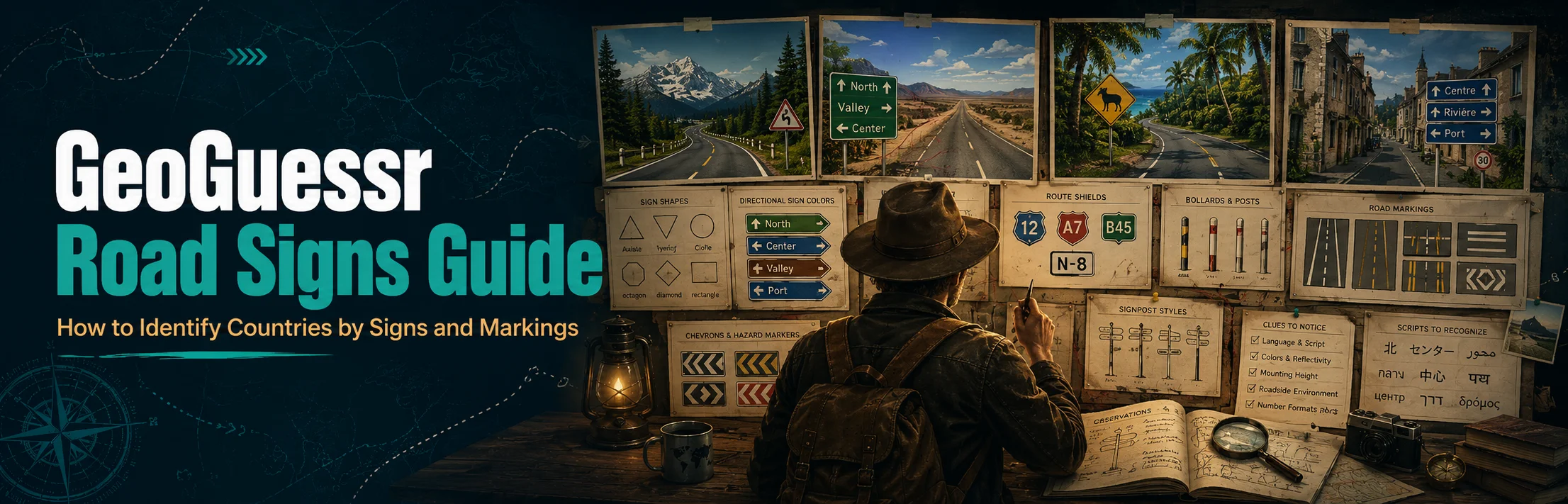
Read the Whole Road System, Not One Sign
A common GeoGuessr mistake is seeing one familiar sign and immediately committing to a country.
Instead, build a combination.
For example:
Together, those clues may be much stronger than any one of them separately.
Think of the road as a complete system.
Check these features together
When examining a road, look at:
Center-line color.
Edge-line color.
Warning-sign shape.
Directional-sign color.
Bollard design.
Signpost construction.
Road shield.
Driving side.
This gives you several independent clues before you guess.
Road Marking Colors Are One of the Best Starting Clues
Road lines remain visible even in low-information rural rounds.
Always check:
GeoHints records large differences between national road-line systems, with white and yellow combinations appearing in different positions depending on the country.
Do not treat white lines as a country clue by themselves
White road markings are extremely common around the world.
Their value comes from the pattern.
Ask:
Are all lines white?
Is the center yellow?
Are only the edges yellow?
Are there no edge lines?
Are the center dashes unusually long?
Are there double center lines?
The combination matters far more than the individual color.
Yellow Outer Lines Are a Major Southern Africa Clue
One of the most valuable road-marking patterns to learn is found across parts of southern Africa.
South Africa commonly uses:
yellow outer edge lines
white center lines
The same general yellow-edge pattern is also found in Botswana, Eswatini, Lesotho, and Namibia, so it should be treated as a southern Africa clue, not automatically a South Africa clue.
How to narrow further
If yellow outer lines point you toward southern Africa, check:
driving side;
route numbers;
directional signs;
landscape;
language;
utility poles.
South African directional signs commonly use green backgrounds, and its major route system includes N and R roads. Neighboring countries use different route-letter combinations.
That makes route shields particularly useful after the road lines establish the region.
Australia Usually Uses White Road Lines
Australia provides a useful contrast.
Australian roads use almost entirely white road markings, apart from limited exceptions such as some alpine areas. Yellow outer lines should therefore push you away from Australia and toward another left-driving possibility, particularly southern Africa when other clues fit.
This becomes especially helpful when an Australian-looking dry landscape could also resemble South Africa.
Australia vs South Africa
If both appear plausible:
Australia
South Africa
left-hand traffic;
yellow outer road lines are common;
triangular red-border warning signs;
different route and bollard systems.
This is a much safer comparison than guessing from vegetation alone.
New Zealand Can Have Yellow Center Lines
Australia and New Zealand are frequently confused.
One useful distinction is that New Zealand can use yellow center-line markings, whereas Australian roads are overwhelmingly white-lined.
Australia also uses almost exclusively white road lines, while its common warning signs are yellow diamonds.
Road lines should still be combined with:
bollards;
road shields;
terrain;
warning signs;
speed signs.
Do not rely on one yellow line without confirming the rest of the scene.
Chile Has Distinctive Road-Line Patterns
Chile is another country where road markings can become highly useful.
Chilean roads commonly use either:
Mixed white-and-yellow line combinations are comparatively uncommon. Plonk It notes that all-yellow road markings are particularly distinctive in the Americas when the environment also fits Chile.
Do not guess Chile from white lines alone
Argentina can also have roads with all-white lines.
Use additional evidence such as:
terrain;
road signs;
bollards;
architecture;
vegetation;
coverage.
Road markings should narrow the field rather than end your investigation immediately.
France Has Some Highly Recognizable Road Markings
France contains several road details worth learning.
Typical French roads can feature:
long, widely spaced outside dashes;
unusually long center dashes;
distinctive paired offset center-line blocks on some roads.
That offset-block center marking is considered a particularly strong French clue when it appears.
France also commonly combines these markings with recognizable directional and route signage, making the road system very useful when text is unreadable.
Warning-Sign Shape Quickly Narrows Regions
Before trying to read a warning sign, look at its shape.
Two major patterns commonly appear:
European-style triangular warning signs
Much of Europe uses triangular warning signs with red borders.
Similar triangular systems also appear in various other countries.
Because they are widespread, a red triangle does not identify a country by itself.
Instead, inspect:
border thickness;
background color;
icon style;
signpost;
nearby road markings.
Yellow diamond warning signs
Yellow diamond-shaped warning signs are strongly associated with countries such as:
United States;
Canada;
Australia;
New Zealand.
That still leaves several possibilities, so pair the sign shape with driving side, road lines, speed signs, and route shields.
Australia and New Zealand both use yellow diamond warning signs, while South Africa uses European-style triangular warning signs.
This makes warning-sign shape particularly useful when separating these left-driving countries.
Directional-Sign Colors Can Reveal the Road System
Large directional signs can provide country clues before you read a single word.
Look at:
France
French directional signs are often white with a black outline on ordinary roads.
Higher-level road directions may use blue or green backgrounds.
Small yellow road-number panels beginning with D are a particularly valuable French clue because departmental road numbers are commonly displayed this way.
Southern Africa
South Africa commonly uses green directional signs, with road numbers shown in yellow.
The letters attached to road numbers can help separate South Africa from neighboring countries.
Australia
Australia commonly uses green directional signs, so green alone does not separate it from many other countries.
Look for its alphanumeric route designations such as A, B, or C roads alongside left-driving traffic and Australian road infrastructure.
Road Shields Can Be More Valuable Than the Road Number
When you see a route number, do not focus only on the digits.
Look at the shape surrounding them.
Countries use:
circles;
rectangles;
shields;
hexagons;
pentagons;
colored panels;
plain text.
GeoHints catalogs road-number sign systems by country because the shield itself can sometimes identify a road network even when the road number is unreadable.
France D-roads
A small yellow panel with a D-number is a strong clue for France.
Mexico
Mexico uses recognizable national and state road shields.
National highway shields may include MEXICO at the top, while state-road designs differ and may contain state abbreviations.
Japan
Japanese prefectural roads commonly use hexagonal route shields.
The prefecture may also be written beneath the number in Japanese characters.
These types of road shields are especially valuable because they remain recognizable even when text resolution is poor.
Mexico Has Several Excellent Road Clues
Mexico offers a useful combination of road signs, lines, and roadside infrastructure.
Common clues include:
white outside road lines;
yellow center lines;
distinctive national and state road shields;
white cylindrical bollards with dark lower sections;
large uppercase lettering on directional signs.
Mexico commonly uses ALTO on stop signs. Plonk It notes that many South American countries instead use PARE, although other Central American countries can also use ALTO.
ALTO is not automatically Mexico
This is important.
Seeing ALTO narrows the region but does not prove Mexico.
Use:
route shields;
bollards;
poles;
road lines;
landscape;
plate shape.
The strongest GeoGuessr clues are combinations.
Stop-Sign Words Can Narrow Language Regions
The red octagonal stop sign is used widely, but the word inside can vary.
Possible text includes forms such as:
GeoHints maintains country-by-country stop-sign references because language and design variations can help narrow a location.
Québec
In Canada, signs reading ARRÊT are a strong Québec clue.
New Brunswick can use bilingual STOP / ARRÊT signage.
This means a stop sign can sometimes take you from continent identification all the way down to a province.
Canada vs United States Road Signs
Canada and the United States can look extremely similar in GeoGuessr.
Road signs provide several useful separators.
Speed signs
Canadian speed signs commonly use MAXIMUM.
United States signs generally use SPEED LIMIT.
Canada uses kilometers per hour, while the United States normally uses miles per hour.
Sign wording
Canadian signs can be less text-heavy than comparable American signs.
For example, some Canadian yield and railway signs rely more heavily on symbols, while American equivalents often contain more written wording.
Road center lines
Canada commonly uses single yellow center lines, although double yellow lines also occur.
Double yellow center lines are generally more common in the United States. This is not absolute, so treat it as supporting evidence.
Speed-Limit Signs Reveal More Than the Number
Do not only read the speed.
Look at the sign design.
Important details include:
circle versus rectangle;
red border;
units;
words such as MAXIMUM;
presence of km/h;
background color.
Australia
Australian speed signs typically show a black number inside a red circle placed on a larger white rectangular panel.
New Zealand
New Zealand commonly uses the red-circle design without the same large white rectangular background seen in Australia.
That difference can be very useful when separating the two countries.
Give-Way and Yield Signs Can Separate Similar Countries
The inverted triangle is widely used, but text and border details vary.
Australia and New Zealand provide a useful example.
Australia's give-way signs commonly use black text, while New Zealand's use red text.
This is a small clue, but it can become decisive when other features already indicate Oceania.
The broader lesson is important:
Do not stop at the sign shape.
Inspect the typography and colors inside it.
Bollards Should Be Read Together With Road Signs
Bollards are not technically traffic signs, but they belong to the same roadside clue system.
They are especially valuable in Europe.
Look for:
post shape;
black panels;
reflector position;
reflector color;
thickness;
rounded or flat tops.
GeoHints maintains an extensive international bollard database because national designs can be surprisingly consistent and distinctive.
Czechia and Slovakia
Czechia and Slovakia share a recognizable bollard style featuring:
Because both countries use the design, it identifies a country pair rather than one country.
From there, language, road numbers, and additional infrastructure can separate them.
Australia and New Zealand Bollards
Australia and New Zealand also have similar-looking roadside posts.
Australian bollards commonly have:
The New Zealand reflector design differs because the red portion can extend farther around the post.
This is an excellent example of why similar countries are best studied side by side.
Chevrons Can Be Surprisingly Country-Specific
Curve chevrons are easy to overlook.
Check:
arrow color;
background color;
border;
number of arrows;
shape.
France and Spain
France commonly uses white arrows on blue chevrons.
Spain can use a similar color scheme, but arrow-count patterns can differ.
South Africa
South Africa commonly uses white-and-red chevrons, including thin single-arrow variants shared with neighboring southern African countries.
San Marino
San Marino has an unusually distinctive combination: yellow chevrons with burgundy-red arrows. Plonk It identifies this as a unique country clue.
Rare clues like this are worth remembering because they can make a difficult round extremely easy.
Signposts Matter Almost as Much as Signs
Sometimes the sign itself is generic, but the pole holding it is not.
Look for:
round poles;
square poles;
flat rectangular poles;
painted poles;
striped poles;
multiple supports;
holes in metal posts.
France
Flat rectangular signposts are common in France, while certain colors and short signposts also occur frequently.
Vietnam
Vietnamese road-sign posts are commonly painted in red-and-white stripe patterns. Warning signs often use yellow-orange backgrounds, a useful regional clue in Southeast Asia.
Colombia
Colombian signposts can have white metal supports that form a recognizable cross shape on the back of a sign.
These clues remain usable even when you approach a road sign from behind.
Always Look at the Back of Road Signs
The back of a road sign may appear useless, but experienced GeoGuessr players often inspect it.
Useful features include:
metal color;
mounting bars;
stickers;
support layout;
painted backs;
post material.
GeoHints has a dedicated international Back of Signs reference because these construction details can vary enough to become geographic clues.
Why this matters in No Move
In a No Move round, the front of a sign may face away from you.
You may still be able to identify:
pole style;
backing material;
mounting hardware.
Instead of dismissing the sign, inspect what remains visible.
Japan Has a Distinctive Road Environment
Japan becomes easier once you learn its complete road system.
Useful features include:
left-hand traffic;
Japanese writing;
mostly white outside lines;
occasional yellow center lines;
white roadside bollards;
hexagonal prefectural route shields;
distinctive road signage.
Japan does not normally use yellow outer edge lines, which helps separate it from some other possibilities.
Prefectural route shields
The hexagonal prefectural road sign is especially useful.
Even if you cannot read the Japanese characters, recognizing the shield shape can strongly support Japan.
Regional players can go further by learning prefecture information displayed with the road number.
Vietnam Has Strong Sign-Color Clues
Vietnam can sometimes be recognized through its road infrastructure even before you read Vietnamese.
Useful features include:
road-sign posts with red-and-white stripes;
yellow-orange warning-sign backgrounds;
blue directional signs;
distinctive roadside waystones.
Within Southeast Asia, the yellow-orange warning-sign appearance can be a particularly useful supporting clue.
Combine this with:
language;
traffic direction;
architecture;
road quality.
Road Signs in Europe Require Smaller Details
Europe is challenging because many countries follow broadly similar conventions.
A red triangular warning sign will not get you very far by itself.
Instead, compare:
border thickness;
poles;
route shields;
bollards;
directional signs;
town-entry signs;
kilometer markers.
France vs Spain
Both can have:
Mediterranean environments;
red-border warning signs;
similar road arrows;
comparable sign conventions.
Useful French clues include:
yellow D-road number panels;
white arrow-shaped directional signs with black outlines;
distinctive outside road dashes;
blue chevrons;
characteristic sign-border details.
Once you learn those small differences, western Europe becomes much less intimidating.
Town-Entrance Signs Can Be Valuable
The sign that marks the entrance to a settlement often has a nationally standardized design.
Check:
background;
border;
font;
whether the town name is uppercase;
whether another administrative name appears;
whether the exit version has a slash.
GeoHints separately catalogs city and town signs because these designs can provide identification and regional information.
Do not ignore a town sign just because you do not recognize the place name.
Its format may be more useful than the name.
Kilometer Markers and Waystones Can Help With Country Recognition
Roadside distance markers often contain:
route number;
kilometer value;
road authority;
color bands;
regional abbreviations.
Mexico
Mexican kilometer markers are commonly white with black text and outline.
Colombia
Colombia has distinctive kilometer-marker designs, including tall green versions marked with Pr as well as traditional stone markers.
France
French kilometer markers frequently use a white base with a colored red or yellow upper section.
These objects can identify a road system before you find a normal directional sign.
Use Road Signs to Separate Similar Countries
The most productive way to study signs is not country by country.
Study confusing pairs.
Australia vs New Zealand
Check:
road lines;
bollards;
speed signs;
give-way text;
route shields.
Canada vs United States
Check:
MAXIMUM vs SPEED LIMIT;
km/h vs mph;
sign wording;
route shields;
road center lines.
France vs Spain
Check:
road-number signs;
directional signs;
signpost style;
chevrons;
road dashes.
Mexico vs South America
Check:
ALTO vs PARE;
route shields;
bollards;
road lines;
poles.
South Africa vs Australia
Check:
yellow outer road lines;
warning-sign shape;
bollards;
route numbers.
Country-pair learning makes road-sign knowledge easier to remember because every clue has a practical comparison.
Do Not Memorize Traffic-Law Meanings First
You usually do not need to know exactly what every road sign legally means.
For GeoGuessr, visual identification is often more useful.
Instead of thinking:
“That is a specific regulatory sign governing passing.”
Think:
“This country uses a white rectangular backing, red circle, short flat post, and this particular road-line pattern.”
Focus first on:
shape;
color;
construction;
placement.
The legal meaning can come later.
Build a Road-Sign Clue Hierarchy
Not all road clues deserve equal confidence.
Very strong clues
These include:
readable country or region name;
distinctive route shield;
highly country-specific bollard;
unique road-sign design;
direct language clue combined with infrastructure.
Strong supporting clues
These include:
road-line system;
directional-sign color;
speed-sign style;
chevrons;
kilometer markers.
Broad clues
These include:
Do not give a broad clue the same weight as something country-specific.
Common GeoGuessr Road-Sign Mistakes
Assuming one sign design is unique
Many countries use traffic standards influenced by the same international conventions.
Always look for secondary clues.
Ignoring road markings
Players often zoom toward signs and overlook the road directly underneath them.
Center and edge markings may be more useful than the sign.
Reading text but ignoring formatting
Even when you understand the language, look at:
font;
sign color;
route shield;
arrows.
The formatting can distinguish countries sharing the same language.
Ignoring signposts
The pole can sometimes be more distinctive than the sign.
Forgetting regional exceptions
Road systems change over time and may vary by region, road type, or local authority.
Treat most visual clues as probabilities unless the feature is genuinely country-specific.
Confusing old and new signage
Street View imagery may have been captured years apart.
Older road signs, plates, and infrastructure can remain visible even after national standards change.
How to Learn Road Signs Efficiently
Start with clues that appear frequently.
The highest-value categories are usually:
road lines;
warning signs;
directional signs;
road shields;
bollards;
speed signs;
chevrons.
Then add less common clues such as:
kilometer markers;
sign backs;
local street signs;
regional post colors.
GeoHints provides visual country references for these categories, while Plonk It country guides explain how the clues interact in actual GeoGuessr locations.
Use external references for learning and reviewing rounds rather than consulting them during competitive games.
GeoGuessr Road Signs FAQ
What road signs are most useful in GeoGuessr?
Warning signs, directional signs, road-number shields, speed signs, town-entry signs, and stop signs can all be valuable. Their usefulness increases when combined with road markings and bollards.
Can road markings identify a country in GeoGuessr?
Sometimes. Certain combinations are highly suggestive, such as yellow outside lines in southern Africa. Most road-line clues are strongest when supported by other infrastructure.
What do yellow road lines mean in GeoGuessr?
It depends on where the yellow line appears. A yellow center line and yellow outer line can point toward completely different regions, so always note the line's position.
Are bollards important for GeoGuessr?
Yes. Bollards are among the most useful country-identification clues, particularly in Europe, because designs often remain consistent across national road networks.
How can I tell Australia from South Africa using roads?
Australia generally uses white road lines and yellow diamond-shaped warning signs. South Africa commonly has yellow outer road lines and triangular red-border warning signs.
How can I tell Canada from the United States using signs?
Canadian speed signs commonly say MAXIMUM and use metric speeds. American signs normally say SPEED LIMIT and use miles per hour. Other sign-wording and road-line differences can provide additional confirmation.
What does a D road sign mean in France?
French departmental roads use D route numbers. Small yellow signs displaying a D-number are a useful French GeoGuessr clue.
Should I memorize every country's road signs?
No. Start with countries you regularly confuse and learn a few high-frequency differences between them.
Can the back of a sign really identify a country?
Yes. Sign backing, posts, mounting bars, stickers, and construction methods can sometimes provide useful country or regional clues.
Final Tips for Identifying Countries by Road Signs
Road signs become much more powerful when you stop viewing them as isolated objects.
Read the whole roadside environment.
A yellow line tells you something. The warning-sign shape tells you something else. The bollard narrows the possibilities further. The route shield may finally identify the country.
Build your guess from that combination.
When you encounter a difficult road round, check:
lines → signs → shields → bollards → posts → driving side
With enough practice, road infrastructure becomes one of the fastest and most dependable ways to recognize countries in GeoGuessr—even when there is no readable place name anywhere in sight.